Comparing Matterport with Other 3D Platforms

Comparing Matterport with Other 3D Scanning Platforms and Technologies

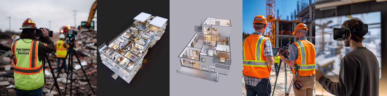
The world of 3D scanning offers a diverse array of platforms and technologies, each tailored with specific strengths suited to different applications within the Architecture, Engineering, Construction (AEC), real estate, and industrial sectors. Matterport has gained significant prominence, particularly for its ability to create immersive virtual tours and its user-friendly approach. This page aims to provide a comparative overview of Matterport alongside other common 3D data capture methods to help you understand their unique capabilities and ideal use cases.
Understanding Matterport: Key Strengths and Common Uses

Matterport systems primarily utilize a combination of photogrammetry and, in newer models like the Pro3, integrated LiDAR, to capture spaces and generate 3D models.
- Core Strengths:
- Immersive Visual Experience: Renowned for creating high-quality, navigable 3D virtual tours, "dollhouse" views, and guided walkthroughs that are highly engaging.
- Ease of Use: The capture process is relatively straightforward, designed for quick adoption and deployment.
- All-in-One Platform: Offers an integrated ecosystem for capturing, processing, hosting, and sharing 3D spaces.
- Speed of Capture for Spaces: Efficiently scans interior spaces like residential homes, commercial offices, and retail locations.
- Cost-Effectiveness for Visuals: For applications prioritizing visual documentation and virtual tours, Matterport can be a very budget-friendly solution.
- Common Uses:
- Real estate marketing and virtual property showings.
- Basic visual construction documentation and progress monitoring.
- Insurance claim documentation (visual evidence of damage).
- Facility management overviews and space planning.
- Virtual staging and interior design presentations.
At Data Capture Service, we utilize advanced Matterport cameras like the Pro3 for its exceptional balance of high-fidelity visual output, dimensional data accuracy for its class, and operational efficiency.
Comparison with Terrestrial LiDAR Scanners (e.g., Leica, Faro, Trimble)

Terrestrial LiDAR (Light Detection and Ranging) scanners are a cornerstone for high-precision 3D data capture.
- Core Technology: These devices emit laser beams and measure the reflected light to determine precise distances, creating highly accurate point clouds.
- Strengths of LiDAR:
- Exceptional Accuracy and Precision: Capable of sub-centimeter accuracy, making them ideal for metrology, detailed As-Built Surveys, and engineering-grade modeling.
- Long Range: Can effectively capture large-scale sites, tall building facades, and extensive infrastructure.
- Dense and Rich Point Clouds: Generate comprehensive datasets that capture intricate details for complex analysis and modeling.
- Robust Performance: Generally less affected by challenging lighting conditions (e.g., direct sunlight, very dark areas) compared to purely photogrammetric systems.
- Where LiDAR Excels or Complements Matterport:
- High-precision As-Built surveys for construction verification and Scan to BIM processes.
- Large-scale topographic mapping and land surveying.
- Industrial plant scanning, reverse engineering of complex components, and deformation analysis.
- Any application demanding survey-grade accuracy and verifiable measurements.
- Considerations: Typically involve a higher investment in equipment or service costs. Data processing can be more complex and may require specialized software and expertise.
Data Capture Service employs advanced terrestrial LiDAR systems, such as those from Leica Geosystems, when projects require the utmost level of accuracy, detail, and range.
Comparison with Handheld 3D Scanners (Structured Light/Laser)
Handheld 3D scanners offer portability and flexibility for capturing smaller or more intricate objects.
- Core Technology: Often use structured light (projecting a pattern of light onto an object) or smaller, integrated laser scanners.
- Strengths of Handheld Scanners:
- Portability and Maneuverability: Excellent for scanning individual objects, complex geometries, or navigating confined spaces where tripod-based systems are impractical.
- Rapid Capture of Smaller Areas/Objects: Can be very efficient for digitizing specific items or detailed sections.
- Good for Reverse Engineering and Inspection: Suited for capturing the detailed geometry of mechanical parts, artifacts, or for quality control inspections.
- Where Handheld Scanners Differ from Matterport:
- Matterport is optimized for capturing entire spaces and environments, whereas handheld scanners typically focus on individual objects or smaller, targeted areas in high detail.
- Creating a cohesive scan of a large room or building with a handheld scanner can be more labor-intensive in terms of data registration and processing compared to Matterport's more automated spatial capture.
- Considerations: Accuracy and resolution vary significantly between models and technologies. The effective scanning range is generally shorter than tripod-based systems.
Comparison with Drone-Based Photogrammetry/LiDAR
Drone (UAV) systems extend 3D data capture capabilities to aerial perspectives.
- Core Technology: Utilize high-resolution cameras for photogrammetry or compact LiDAR sensors mounted on unmanned aerial vehicles.
- Strengths of Drone Systems:
- Aerial Data Capture: Ideal for inspecting roofs, mapping large tracts of land, surveying stockpiles, capturing exterior building facades, and accessing dangerous or otherwise inaccessible areas.
- Rapid Coverage of Large Exterior Areas: Can efficiently map extensive outdoor sites, farmlands, or construction zones.
- Where Drone Systems Differ from Matterport:
- Matterport is primarily designed for capturing interior spaces and immediately adjacent exteriors from a terrestrial viewpoint.
- Drones excel at capturing large-scale outdoor environments, high elevations, and providing comprehensive aerial overviews.
- Considerations: Subject to aviation regulations and airspace restrictions. Flight operations can be weather-dependent. Accuracy is influenced by sensor quality, flight altitude, and ground control.
Making the Right Choice: It Depends on the Application
There is no single "best" 3D scanning platform; the optimal choice is always dictated by the specific requirements of the project. Key factors to consider include:
- Required Accuracy and Level of Detail: Is visual representation sufficient, or are engineering-grade measurements needed?
- Size and Complexity of the Subject: Is it a small object, a room, an entire building, or a large outdoor site?
- Project Budget and Timeline: What are the financial and time constraints?
- Intended Use of the Data: Will it be for a virtual tour, construction verification, BIM modeling, or volume calculations?
- Environmental Conditions: Is the project indoors, outdoors, in bright light, or in dark areas?
How Data Capture Service Helps You Choose
Navigating the options in 3D scanning technology can be complex. At Data Capture Service, we have hands-on experience with a range of leading platforms, including Matterport and high-precision LiDAR systems. We work closely with our clients to:
- Thoroughly understand their project objectives and deliverables.
- Assess the specific requirements for accuracy, detail, and scope.
- Recommend and deploy the most appropriate technology, or combination of technologies, to achieve the desired outcome efficiently and cost-effectively.
Our goal is to ensure you receive the right data, in the right format, to make informed decisions and drive your project's success.
Understanding the distinct advantages and limitations of Matterport compared to other 3D scanning technologies allows for informed decision-making, ensuring the chosen method aligns perfectly with project goals and desired outcomes.
Ready to explore in more?
Start here:


How Matterport Enhances Real Estate Listings
Virtual Tours with Matterport: Use Cases by Industry
Prefer to Speak Directly?
Experience precision in every project.