
Top challenges in capturing existing building conditions and how to avoid them
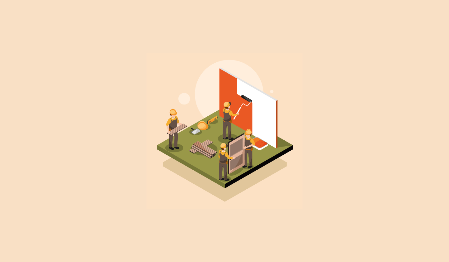
Capturing existing building conditions accurately is the cornerstone of every renovation, restoration, or facility upgrade. Before any design or construction work begins, teams rely on this foundational data to make critical decisions—from structural modifications to system upgrades and space planning. Yet, despite its importance, the process is often riddled with challenges that can derail timelines, inflate budgets, and compromise design integrity.
Inaccurate or incomplete as-built information remains one of the biggest risks in the AEC industry. Outdated drawings, inaccessible areas, and inconsistencies between physical structures and documentation can all lead to costly surprises once work begins. The result? Rework, delays, and friction between design intent and real-world execution.
Fortunately, modern data capture technologies—such as LiDAR scanning, photogrammetry, and BIM integration—are transforming how professionals document existing spaces. When paired with the right strategies and expertise, these tools make it possible to gather comprehensive, high-precision data faster and safer than ever before.
In the following sections, we’ll explore the most common challenges in capturing existing building conditions—and, more importantly, the proven ways to avoid them.
The Importance of Accurate Existing Building Documentation
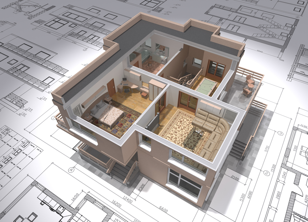
Every building tells a story—one written in layers of materials, mechanical systems, and design decisions accumulated over time. Before architects, engineers, or contractors can write the next chapter through renovation or retrofitting, they must first understand what already exists. This is where accurate existing building documentation becomes invaluable.
When teams work with incomplete or outdated data, they’re essentially designing in the dark. A single incorrect measurement can cascade into larger issues: misaligned structural elements, clashes between new and existing systems, or entire redesigns once construction reveals unforeseen conditions. According to industry studies, rework due to inaccurate as-built information can add anywhere from 5% to 15% in additional project costs—a margin that can easily erode profitability.
Beyond the financial impact, inaccurate documentation also threatens project safety and schedule integrity. Construction crews depend on verified drawings to coordinate trades, plan installations, and maintain structural stability during renovations. A missing beam, unrecorded column, or mislocated mechanical duct could easily disrupt weeks of progress or even create on-site hazards.
Modern scanning technologies—such as LiDAR, photogrammetry, and reality capture—have significantly improved the reliability of existing condition assessments. By generating high-precision 3D point clouds and integrating them into BIM environments, teams can visualize the structure as it truly stands, not as it was once drawn. This allows for better clash detection, spatial analysis, and design accuracy from the earliest stages of planning.
Ultimately, the importance of accurate existing building documentation lies in one core truth: you can’t design the future if you don’t fully understand the present. With the right data as your foundation, every subsequent decision—from design detailing to construction execution—becomes more predictable, efficient, and successful.
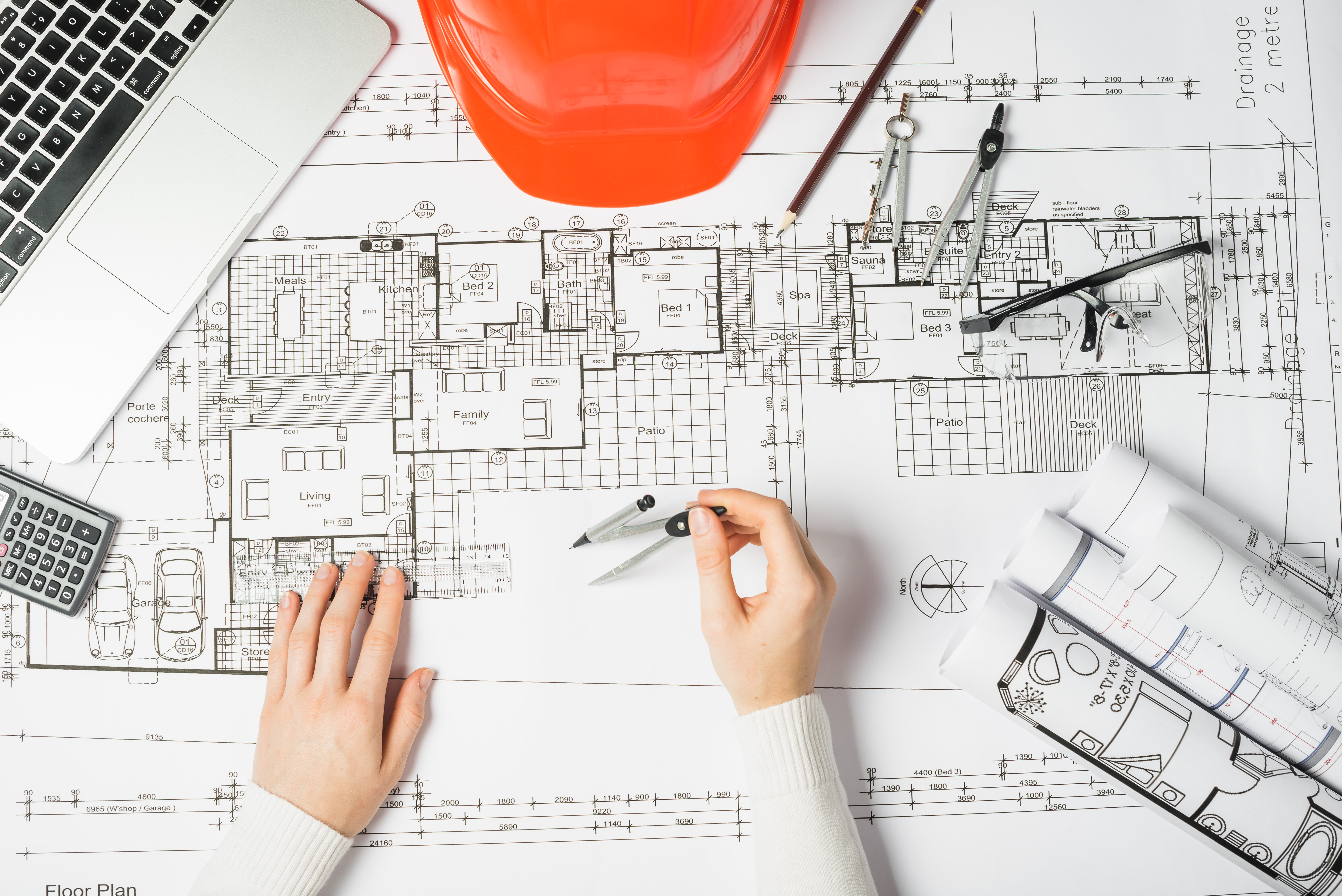
Challenge #1 – Incomplete or Outdated Existing Documentation
One of the most common and costly challenges in capturing existing building conditions is starting with documentation that’s either incomplete, outdated, or inaccurate. Many older buildings lack reliable “as-built” drawings, and even when they exist, they often fail to reflect decades of renovations, repairs, and system upgrades that have taken place since the original construction.
This issue is especially prevalent in legacy properties—commercial offices, institutional campuses, and industrial facilities—where design modifications were made incrementally, without properly updating the official documentation. Architects and engineers tasked with renovations often find themselves making assumptions based on drawings that are years, or even decades, out of date. The result is a domino effect of design conflicts, inaccurate quantities, and unexpected site conditions once construction begins.
The consequences can be significant. A misplaced wall or unrecorded utility line might not seem catastrophic on paper, but in the field, it can halt work, trigger change orders, and inflate costs far beyond the original budget. Worse, these surprises can compromise design integrity or lead to unsafe conditions during demolition or retrofitting.
How to Avoid This Challenge
- Conduct a Comprehensive Site Survey
Before any design work begins, schedule a full on-site assessment to verify existing conditions. Walk the site with both designers and field technicians to identify discrepancies between current drawings and physical reality. Document these differences meticulously. - Adopt Digital Scanning Technologies
LiDAR and photogrammetry scanning provide millimeter-level accuracy and capture every visible surface within a space. This data can be processed into 3D point clouds and used to generate precise as-built models. Unlike manual measurements, these scans capture every element—visible or hidden—ensuring no details are overlooked. - Maintain a Centralized Data Repository
Once captured, all site data should be stored in a single, cloud-based environment accessible to the entire project team. This eliminates version confusion and ensures everyone works from the same, most up-to-date information set. Integrating this data directly into your BIM workflow ensures accuracy across all stages of design and coordination. - Verify and Update Regularly
Treat existing building data as a living record, not a one-time task. Whenever modifications or inspections occur, update your documentation to reflect new realities. This proactive habit saves enormous time and resources over the long term.
Incomplete or outdated documentation doesn’t just slow down a project—it introduces uncertainty at every stage. The key to avoiding it is combining technology with disciplined data management practices, ensuring that every team member has a clear and current picture of the space they’re working within.
Challenge #2 – Accessibility and Safety Constraints
Even the best-trained teams and most advanced equipment can struggle to capture building conditions when parts of the structure are physically hard to reach or unsafe to access. Roof cavities, mechanical chases, high ceilings, crawl spaces, or deteriorated areas often pose significant barriers to traditional surveying and measurement methods. In older or partially occupied buildings, accessibility challenges multiply—some zones may be locked off, structurally unstable, or filled with active systems that can’t be shut down during business hours.
These limitations often lead to incomplete data collection, forcing teams to make assumptions or skip certain sections altogether. The result is a patchwork of information that undermines the accuracy of the entire dataset. In high-stakes projects—such as hospitals, heritage buildings, or industrial facilities—those gaps can have serious operational or safety implications once construction begins.
Accessibility challenges also present safety concerns for on-site personnel. Manual measurements using ladders or scaffolding expose workers to falls, confined space hazards, and exposure to hazardous materials like asbestos or lead paint. The risk is compounded when documentation teams work in active facilities, where equipment, utilities, or occupants are still present.
How to Avoid This Challenge
- Leverage Remote and Aerial Technologies
Modern tools such as drones and handheld LiDAR scanners allow teams to document inaccessible areas safely from a distance. Drones equipped with high-resolution cameras and laser sensors can capture exterior façades, rooftops, and tall structures with minimal disruption. Handheld or mobile scanning units excel in tight spaces and can easily maneuver around obstacles. - Integrate Safety Planning into Data Capture
Safety shouldn’t be an afterthought—it must be embedded in the planning process. Conduct hazard assessments before scanning begins and develop specific protocols for high-risk areas. This may include temporary supports, restricted zones, or supervised access during capture. - Schedule Work During Low-Activity Hours
For occupied or operational facilities, schedule scanning sessions during off-peak hours or weekends. This reduces interference with ongoing activities and allows for safer, more controlled data collection environments. - Collaborate with Experienced Technicians
Partner with specialists trained in working around hazardous or sensitive environments. Experienced scanning technicians understand how to operate in tight, high, or restricted spaces efficiently while maintaining safety compliance and data accuracy.
By combining the right equipment with proactive safety and access planning, teams can overcome even the most challenging environments. The goal is to eliminate data gaps—not expose personnel to unnecessary risks. In modern building documentation, accessibility challenges are no longer excuses for incomplete data—they’re opportunities to innovate with safer, smarter methods.
Challenge #3 – Accuracy and Calibration Issues
Even with high-end laser scanners and advanced photogrammetry software, the accuracy of building documentation ultimately depends on one thing: precision control. A single calibration error, misaligned scan, or environmental interference can introduce millimeter-level distortions that snowball into significant design errors once the data is integrated into CAD or BIM workflows.
In practice, this issue often arises when scanners are not properly calibrated before or during capture. Temperature fluctuations, vibration, and operator error can subtly distort readings, leading to inconsistencies between overlapping scans. Over large structures or multi-floor buildings, these small errors accumulate, causing point cloud misalignments or dimensional inaccuracies that affect the entire model.
Even more problematic is when teams skip quality checks due to time pressure. They may assume their equipment and software will automatically correct errors—but automation can only do so much. The result is a dataset that looks complete but fails under closer scrutiny during design or coordination phases. When contractors discover these errors on-site, rework, redesign, and cost overruns quickly follow.
How to Avoid This Challenge
- Regularly Calibrate All Scanning Equipment
Calibration should be treated as a mandatory pre-scan procedure. Follow manufacturer recommendations for frequency and method, especially after transportation, impact, or exposure to extreme environmental conditions. Maintain calibration logs for quality control documentation. - Establish Standardized Capture Workflows
Consistency across all scans is critical. Define clear parameters for scanner placement, overlap, resolution, and environmental settings. A well-documented scanning protocol ensures every technician collects data in a uniform way, reducing variability between sessions and operators. - Account for Environmental Conditions
Temperature, humidity, and lighting can affect sensor accuracy. For example, reflective surfaces or bright sunlight can distort LiDAR readings. Plan scans during optimal conditions whenever possible, and adjust parameters for environmental realities. - Cross-Verify and Validate Data
Always verify point clouds against known reference points, such as fixed control markers or architectural benchmarks. Use alignment checks within software to detect and correct inconsistencies early. This step should happen before modeling or measurement extraction begins. - Implement Quality Assurance (QA) Checks
Build a QA/QC process into every project. Have a second technician review sample scan areas for alignment and completeness. Automated QA tools within BIM software can flag potential discrepancies before they propagate downstream.
In the end, accuracy isn’t just about technology—it’s about discipline. Reliable data capture depends on consistent calibration, thorough planning, and rigorous validation. When these practices are followed, the output isn’t just a 3D representation of a space—it’s a digital truth that designers and builders can depend on with confidence.
Challenge #4 – Data Overload and File Management
Modern data capture tools—such as LiDAR scanners, drones, and 360° cameras—are capable of producing enormous amounts of data in very little time. A single comprehensive scan of a large facility can easily generate hundreds of gigabytes of point clouds, images, and metadata. While this volume of information is valuable, it also introduces a major operational challenge: managing, processing, and storing it efficiently.
Without proper organization and infrastructure, raw scan data can quickly overwhelm project teams. Common issues include overloaded hard drives, lost file versions, slow rendering times, and confusion over which dataset is the “most current.” As teams attempt to integrate this data into BIM or CAD workflows, mismatched file formats and software compatibility issues further slow progress. These inefficiencies don’t just cost time—they increase the risk of design errors and coordination breakdowns.
Many firms underestimate the technical requirements for handling large datasets. Even high-performance computers can struggle with massive point clouds, especially when multiple stakeholders need simultaneous access. Inadequate file management can also lead to security vulnerabilities, where sensitive building data is stored on unsecured drives or transmitted via unencrypted methods.
How to Avoid This Challenge
- Use Cloud-Based Collaboration Platforms
Cloud solutions such as Autodesk BIM 360, Trimble Connect, or NavVis IVION allow teams to store, visualize, and collaborate on large datasets in real time. Cloud platforms centralize data, eliminate version confusion, and enable instant access from anywhere without the need for large local file transfers. - Develop a Data Management Protocol Early
Establish file naming conventions, folder hierarchies, and access permissions before data collection begins. This ensures all captured files are systematically organized and easily retrievable. Assign one person or team to oversee version control and data updates. - Leverage Compression and Optimization Tools
Specialized software can compress or segment point clouds without compromising accuracy. This allows for faster rendering, easier sharing, and smoother performance within design tools like Revit, Archicad, or AutoCAD. - Integrate Data Directly into BIM Workflows
Avoid treating scan data as an isolated deliverable. Instead, connect it directly to your Building Information Modeling (BIM) environment, allowing designers and engineers to reference real-world geometries seamlessly during modeling and coordination. - Plan for Long-Term Storage and Security
Large datasets need secure, scalable storage solutions. Use encrypted cloud storage or enterprise-grade servers that can handle terabytes of data. Maintain backups and ensure all data complies with relevant privacy or project-specific security standards.
When managed correctly, big data becomes an asset rather than a burden. Well-structured file systems, cloud workflows, and data governance frameworks not only improve efficiency but also enhance collaboration across all project stakeholders. The goal isn’t to capture less data—it’s to make your data work smarter, not harder.
Challenge #5 – Integrating Data into Existing Design Workflows
Capturing detailed, high-accuracy data is only half the battle. The real challenge begins when teams attempt to integrate that data into their existing design and documentation workflows. Even the best scanning or photogrammetry output can become a bottleneck if it doesn’t align seamlessly with the firm’s software ecosystem, file structure, or modeling standards.
In many projects, data captured in the field is delivered in massive point cloud files that architects and engineers struggle to import or manipulate. File incompatibility, oversized datasets, and lack of standardized deliverables often force teams to spend hours—or even days—converting, cleaning, and aligning scans before they can begin modeling. The result is unnecessary frustration, lost productivity, and a diminished return on the investment made in capturing that data.
Another frequent issue arises when scanning teams and design teams operate in silos. If expectations for coordinate systems, file formats, or levels of detail (LOD) are not clearly defined upfront, integration becomes a guessing game. Misaligned coordinate systems can cause model offsets or misplacement within BIM environments, which in turn leads to incorrect measurements, poor coordination, and clashes later in design or construction.
How to Avoid This Challenge
- Define Deliverables and Formats Before Scanning
Before fieldwork begins, project managers should coordinate between the scanning provider and the design team to clearly define deliverable expectations. Specify the required file formats (e.g., .RCP, .E57, .LAS), coordinate systems, and LOD to ensure compatibility with the design team’s software tools. - Collaborate with Providers Familiar with Design Workflows
Work with scanning professionals who understand the downstream applications of their data. Providers with BIM and CAD expertise can tailor data output to integrate smoothly with your design environment—reducing conversion work and ensuring geometry aligns correctly with your project base files. - Use Interoperable Platforms and Plug-ins
Modern software ecosystems now include powerful plug-ins and cloud connectors that allow direct integration between point clouds and modeling tools. Autodesk Recap, for instance, enables seamless import into Revit or AutoCAD, preserving metadata and coordinate alignment. - Establish Consistent Project Standards
Create a company-wide or project-specific BIM Execution Plan (BEP) that defines how existing conditions data should be structured, named, and referenced. This ensures that all stakeholders—from scanning technicians to modelers—follow a consistent data standard. - Perform Alignment Verification Early
Once data has been imported into your modeling environment, perform a quick verification against known control points or benchmarks. Detecting misalignment early prevents cascading errors in subsequent design phases.
Integrating captured data into design workflows isn’t just about file compatibility—it’s about communication and planning. When teams align their expectations, establish clear standards, and collaborate across disciplines, data capture transforms from a one-off task into a powerful design accelerator. The end goal is simple: field data that flows effortlessly from capture to construction.
Challenge #6 – Human Error and Lack of Standardization
Even with the most advanced technology available, human error remains a persistent obstacle in achieving truly accurate building documentation. The reality is that technology is only as reliable as the people operating it—and without standardized workflows, training, and verification methods, inconsistency creeps in quickly.
In many organizations, different team members or subcontractors perform scanning and documentation using slightly different techniques, naming conventions, or settings. Over time, these inconsistencies create a fragmented dataset that’s difficult to merge or verify. One project might use imperial units while another records in metric; one technician may capture extra context photos while another omits them entirely. When this data is combined, mismatched formats and variable quality undermine confidence in the final deliverable.
Another source of error arises from rushed fieldwork or insufficient training. Operators may set up scanners incorrectly, overlook key reference points, or fail to maintain proper overlap between scan stations. While each mistake may seem minor, collectively they can distort measurements and introduce major discrepancies downstream—forcing rework in both the digital and physical environments.
How to Avoid This Challenge
- Develop and Enforce Standard Operating Procedures (SOPs)
Create a formalized, repeatable workflow that outlines every aspect of the data capture process—scanner setup, calibration, station spacing, naming conventions, and file handling. SOPs ensure consistency across all team members and projects, regardless of who performs the work. - Train and Certify Field Technicians
Regular training should be non-negotiable. Teams should understand not only how to operate scanning equipment but also why specific methods matter. Certification programs and internal QA assessments help reinforce good practices and minimize guesswork in the field. - Use Checklists and Field Verification Steps
Introduce checklists for every scanning session to confirm that calibration, coverage, and documentation steps are completed. Field verification—spot-checking dimensions against known benchmarks—adds another layer of protection against oversights. - Implement Internal QA/QC Reviews
Once data is captured, assign a separate team member to review and validate the dataset before it’s delivered or modeled. This ensures a second set of eyes catches potential inconsistencies, missing areas, or misalignments. - Centralize Templates and File Structures
Store templates, naming conventions, and SOPs in a shared repository accessible to all team members. This reduces the likelihood of version drift and ensures everyone works from the same playbook.
Standardization is the backbone of reliable data capture. When every team follows the same structured workflow—from setup to delivery—accuracy becomes predictable, efficiency improves, and the final output gains credibility. Human error can never be eliminated entirely, but with discipline, documentation, and training, it can be reduced to near zero.
Challenge #7 – Budget and Time Constraints
In the fast-paced world of architecture, engineering, and construction, project teams constantly face pressure to deliver results quickly and cost-effectively. Unfortunately, when it comes to capturing existing building conditions, these pressures often lead to shortcuts that can cost far more in the long run.
Many firms—especially when operating under tight budgets—choose to perform partial scans, skip certain validation steps, or rely on outdated drawings to save time. Others delegate data capture to less experienced staff or underinvest in modern technology. While these choices may reduce upfront costs, they often create a cascade of downstream issues: design clashes, rework, change orders, and schedule overruns once construction begins.
The irony is that inaccurate or incomplete documentation typically ends up being one of the most expensive mistakes a project can make. Industry studies consistently show that up to 30% of total project cost overruns are tied to poor or missing data during early-stage planning. In other words, cutting corners during documentation doesn’t save money—it shifts the cost burden to later phases, where fixes are exponentially more expensive.
How to Avoid This Challenge
- Prioritize Data Capture Early in the Project Timeline
Treat site documentation as a critical investment, not a checklist item. Conduct scanning and verification before design begins to give teams enough time to process and integrate accurate data without rushing. - Educate Stakeholders on the ROI of Accurate Data
Communicate the tangible benefits of proper documentation to clients, developers, and project managers. When stakeholders understand that precise building data reduces change orders, improves coordination, and accelerates design, they’re more likely to allocate sufficient resources. - Use Tiered Scanning Strategies
Not every area requires the same level of detail. Prioritize high-impact zones—such as structural intersections, MEP rooms, or façade areas—for high-resolution scanning, while applying lower-density capture methods for less critical spaces. This balances time, cost, and quality effectively. - Work with Experienced Service Providers
Partnering with a professional data capture team streamlines the process and avoids costly rework. Experienced providers know how to optimize scanning routes, minimize downtime, and deliver BIM-ready outputs on schedule and within budget. - Plan for Contingencies
Build modest buffers into both schedule and budget to account for unforeseen conditions discovered during scanning. This proactive planning prevents small surprises from becoming project delays.
When teams resist the temptation to rush or underfund data capture, they set themselves up for smoother design and construction phases. Investing a little more time and money upfront ensures fewer surprises, fewer disputes, and a more predictable path to project success.
Conclusion
Capturing existing building conditions accurately is no longer a tedious, error-prone process—it’s a strategic foundation for smarter design, safer construction, and better long-term asset management. The challenges are real, but they’re entirely avoidable when teams combine the right technology, workflow discipline, and expertise.
To recap, three key lessons stand out from this discussion:
- Accurate data capture minimizes costly surprises during design and construction. Reliable as-built documentation ensures decisions are made on facts, not assumptions.
- Modern tools and workflows eliminate traditional documentation barriers. LiDAR, drones, AI, and BIM integration allow teams to capture more detail in less time.
- Professional data capture services deliver precision, safety, and efficiency. Partnering with experienced providers reduces risk, improves workflow integration, and ensures projects start with confidence.
If your next renovation, retrofit, or facility upgrade depends on understanding your building as it truly exists, it may be time to invest in a professional data capture service. Our service provides complete 3D scanning and LiDAR-based documentation, BIM-ready deliverables, and seamless integration into your existing workflows. From initial site assessment to verified digital models, every stage is handled by experts who know how to balance accuracy, speed, and cost-effectiveness.
By transforming existing conditions into high-quality, usable data, our data capture service gives architects, engineers, and contractors the clarity they need to design and build with confidence—every time.
Ready to take the next step? Discover how our data capture solutions can simplify your next project and eliminate the risks of inaccurate documentation.
Prefer to Speak Directly?
Experience precision in every project.
