Scan to BIM Services: Convert Reality into Intelligent 3D Models
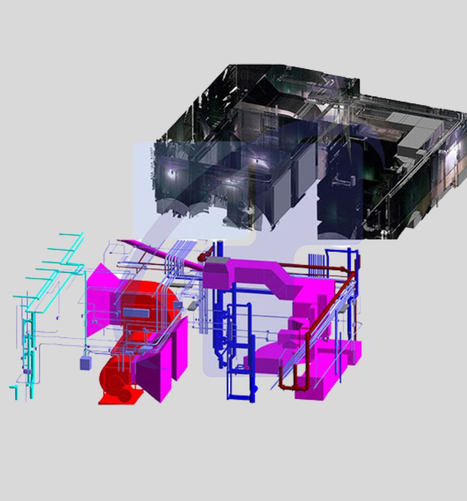
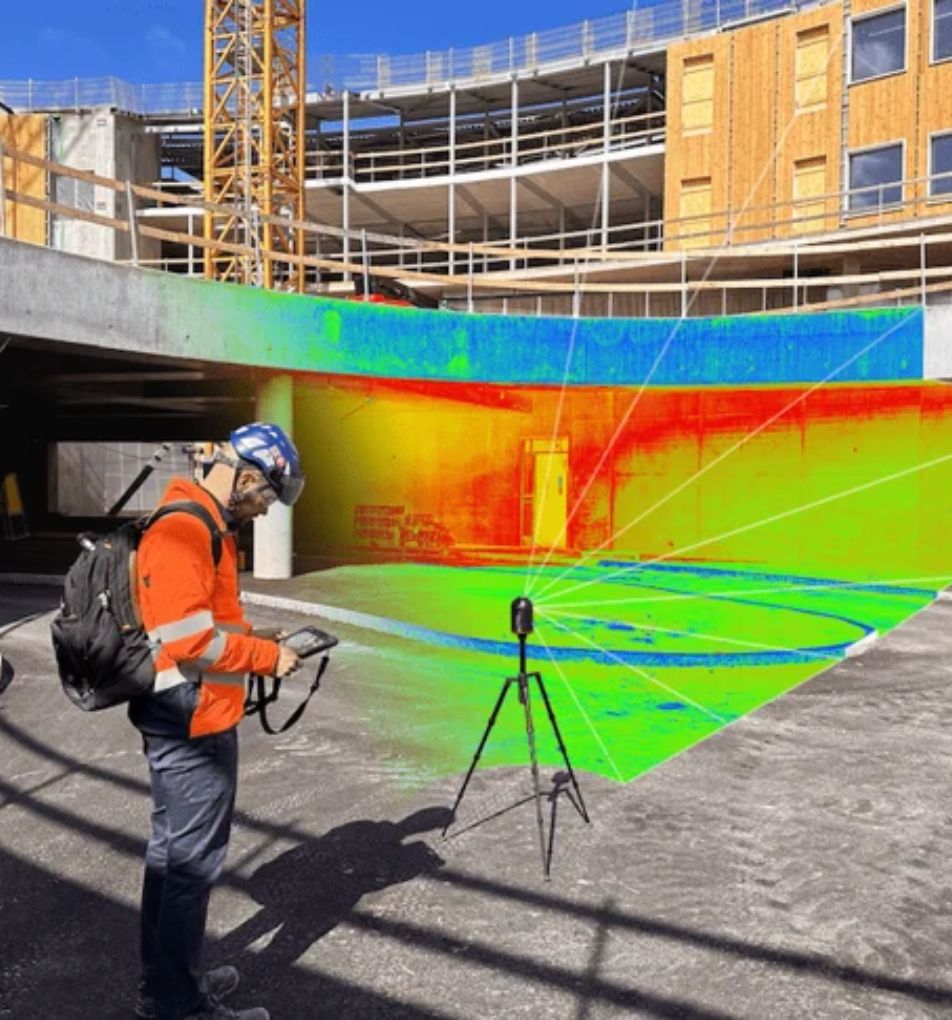
Our advanced laser scanning technology converts existing conditions into precise BIM models, perfect for facility management and clash detection.
Millimetre-accurate scans, single site visit
Revit models delivered in days, not weeks
LOD-matched output for any project phase
Built-in clash sets for early detection
Seamless data link to FM platforms
iPhone mockup
Our Trusted Partnerships
From Point Cloud to Revit—Seamlessly

Transform raw laser data into clash-detectable BIM

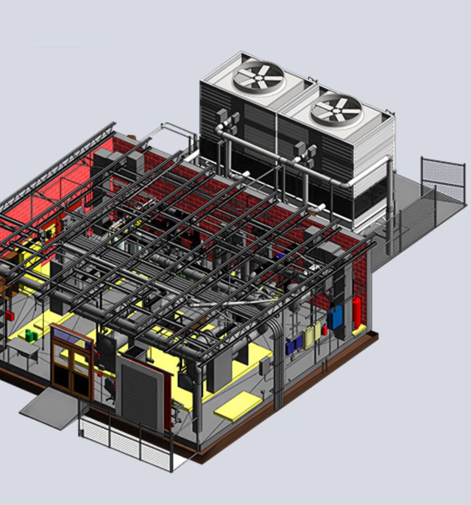
We fuse terrestrial and drone LiDAR to register a colourised point cloud, then our BIM specialists model structural, architectural, and MEP elements to the exact Level of Development your project demands (LOD 200-400 standard, LOD 500 on request). The final deliverable slots straight into Navisworks, Solibri, or your CDE, giving every stakeholder a trusted 3D reference for coordination, quantity take-offs, and lifecycle management.
Dashboard mockup
Dashboard mockup

Key Benefits of Professional Scan to BIM Services

A laser-verified BIM model eliminates the disconnect between drawings and reality. With a single capture you gain a collaborative platform that reduces design risk, accelerates schedules, and pays dividends long after handover.
Reality-Aligned Design Foundations
Model walls, slabs, and services against millimetre-true geometry, ending “field fit” frustrations and redraws.
Early Clash Detection & Resolution
Structural, architectural, and MEP layers sit in one file, so conflicts surface in coordination meetings—not on site.
Faster Quantity Take-Offs
Quantity surveyors pull exact volumes and counts from the model, trimming days off estimating cycles and improving cost certainty.
Streamlined Fabrication & Installation
Laser-accurate BIM feeds directly into CNC and prefabrication workflows, cutting waste and tightening installation tolerances.
Lifecycle Digital Twin
Owners inherit an as-built BIM that links to asset tags, warranties, and maintenance schedules, simplifying FM and future retrofits.

Enhanced Collaboration & Lifecycle Management

Beyond just visuals, our BIM models are data-rich, enabling superior facility management, streamlined maintenance, and proactive clash detection. This not only prevents costly errors during construction but also supports the entire lifecycle of your building, fostering better collaboration among all stakeholders.
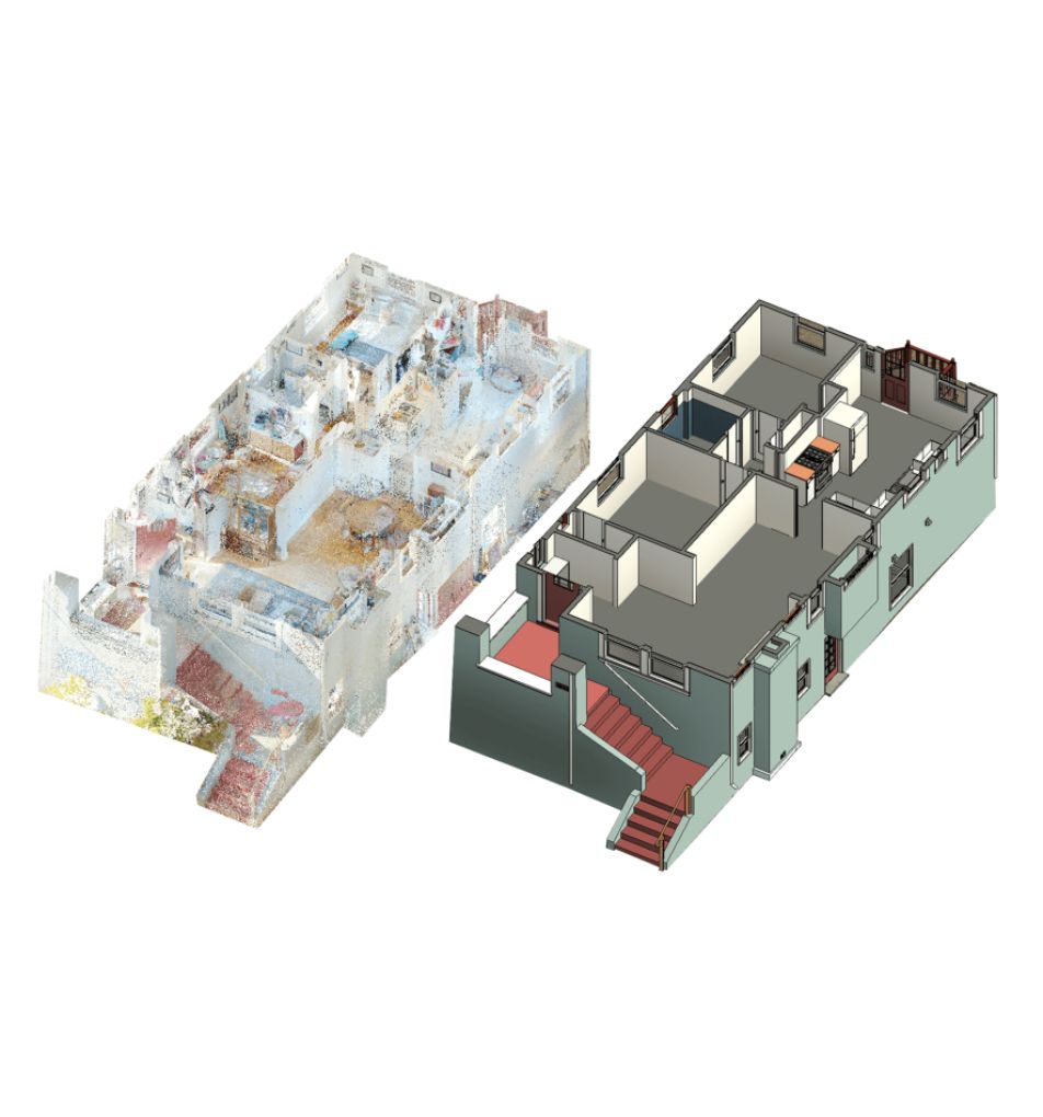
Bridging the Physical and Digital Divide

Our Scan to BIM services utilize advanced laser scanning to capture your existing conditions with unparalleled accuracy. We then meticulously convert this data into intelligent BIM models, creating a comprehensive digital twin of your physical space. This process bridges the gap between the real world and your design environment, providing a robust platform for informed decision-making.

Industries We Serve

Leveraging advanced 3D LiDAR and scanning, we empower every sector to operate with precision and confidence.

Construction

Empowering construction teams with accurate as‑builts and BIM data, reducing rework, costs, and schedule overruns.

Architechture

Bringing visionary designs alive through precise 3D scans that accelerate concept validation and stakeholder alignment.

Facilities Management

Delivering detailed spatial insights for proactive maintenance, and optimized space utilization across facilities.

Engineering

Supplying precise point clouds and CAD data, enabling engineers to analyze, simulate, and innovate confidently.

Commercial Real Estate

Delivering immersive virtual tours that accelerate informed decisions for commercial property transactions.

Entertainment

Creating digital twins for location scouting, set design, and interactive experiences that enthrall audiences worldwide.

What Do We Do?

At Data Capture Services, we specialize in delivering high-quality, precise data solutions tailored to your project's needs. Our state-of-the-art technology and expert team ensure you receive the best possible results for your industry.

As-built

As-Built Documentation

We provide detailed and accurate as-built drawings that reflect the exact state of your project, making modifications and future planning seamless.

Building Information Modeling

Scan to BIM

Our advanced laser scanning technology converts existing conditions into precise BIM models, perfect for facility management and clash detection.

Scan to BIM

3D Scanning

Using cutting-edge 3D scanning equipment, we capture intricate details of existing structures, ensuring no aspect is overlooked.

floor plan

Floor Plans

We deliver precise floor plans that ensure high standards of quality and accuracy for any project.

A professional surveying a building

Building Surveys

Our comprehensive as-built surveys verify project compliance and create an accurate record of completed work, essential for future reference.

virtual tour

Virtual Tours

Experience immersive virtual tours that provide a detailed and interactive view of your space, enhancing planning and presentation capabilities.

Specialized Services

From emergency restoration to architectural planning

a professional documenting a site of a collapsed building

Emergency Restoration Documentation

Swift, precise 3D scans for damage assessment, expediting insurance claims and restoration planning.

as-built

Architectural & Construction Scanning (AEC)

Accurate as-built models and BIM-ready data for informed design, construction, and renovation decisions.

a man managing inventory

Inventory Management

Comprehensive digital cataloging of assets and documents for efficient facility management.

a trainee experiencing virtual tour

Industrial Training & Safety Simulations

Immersive virtual environments for enhanced safety training and operational efficiency.

virtual tour

Property Documentation

Detailed 3D capture of historical structures, creating precise digital archives for conservation.

as-built

As-Built Documentation & Verification

Exact 3D representations of existing structures, ensuring accuracy for renovations and management.

Our Speciality

Harnessing cutting-edge 3D scanning and LiDAR technology, we specialize in delivering diverse dataset plans tailored to our clients' needs. Partnering with a wide range of businesses and organizations, we provide precise existing condition drawings essential for achieving project objectives.

floor plan

Experience the Power of Virtual Tours

Immerse yourself in one of our recent projects. Our virtual tours provide stakeholders with an interactive, true-to-life representation of spaces, enhancing decision-making and planning processes across industries.

What We Do?

Harnessing cutting-edge 3D scanning and LiDAR technology, we specialize in delivering diverse dataset plans tailored to our clients' needs. Partnering with a wide range of businesses and organizations, we provide precise existing condition drawings essential for achieving project objectives.

Cutting-Edge Technology at Your Service

We utilize the latest in 3D scanning and LiDAR technology to ensure unparalleled accuracy and efficiency in our data capture services. Our state-of-the-art equipment includes:

iguide

iGUIDE

Delivering accurate floor plans and property measurements

matterport pro3

Matterport Pro 3

For immersive 3D walkthroughs

leica blk360

Leica BLK 360

Providing high-precision point cloud data

Leica RTC 360

Captures environments in 3D with  speed and accuracy

Why Choose Data Capture Service?

Cutting-edge Technology

State-of-the-art equipment for unparalleled precision

Certified Excellence

IICRC certified, ensuring industry-standard quality

Customized Solutions

Tailored approaches to meet your unique project needs

Industries We Serve

construction site

Architecture, Engineering, and Construction (AEC)

Precise 3D scans for accurate as-builts, BIM modeling, and CAD files to enhance decision-making.

room damaged by flood water

Emergency Services and Disaster Recovery

Swift, detailed damage assessment and documentation to expedite insurance claims and streamline restoration efforts.

government building

Education and Government

Comprehensive facility mapping for space optimization, safety planning, and virtual training simulations.

factory

Manufacturing and Industrial

Detailed plant layouts, equipment modeling, and immersive safety training environments for efficiency.

What Our Clients Say

Discover how our precise data capture services have transformed projects and exceeded expectations through our satisfied clients' successes.

"I can't say enough about how Data Capture Services has impacted our business. As the owner of Real Property Management Midtown Services is everything, and by them handling our professional photographs for our listing and our semi-annual property evaluations it's been nothing short of a Win Win.  They've truly helped us be more efficient and effective by utilizing their services, which ultimately has impacted our bottom line.  I highly recommend their services!!!"
william harris profile

William Harris

Property Manager

Excellent work product and professionalism. Working with Data Capture Service team has been very helpful in growing our business. Their team always stay on top of any work we give them! 100% recommend

Nitish Khullar

Property Manager

"Very fast , came same day and did a very great job , I will use him again. He always give good deals on price that meets your budget."

Setonji Ofade

Property Manager

"The whole team is great! Them having knowledge of the water mitigation industry really is a huge plus! I would definitely recommend them to anyone that is in need of a 3D scan! Competitive pricing, fast turn around on all scans and a great detailed sketch of the scan."

Erik Ballester

Property Manager

"Thank you for always providing a quick turn around, and great customer service.  Highly recommend you guys. Not only do you always answer calls, but your services have yielded us great results for our clients by using accurate measurements on losses."

Restoration Services

Restoration

"It has been great experience working with Data Capture Service. Very professional, diligent team we have used with our business services. Highly recommended."

Real Property Management

Real Estate

"Ramon was awesome and very professional. Would recommend."

Jaime Hodges

Realtor

"Amazing service and perfect quality!! Will definitely use again!"

Nick Lokken

Customer

"Great services! Very friendly! Do recommend, the pics are A1 😎 …"

K Los

Realtor

"Great service very professional"

Kylie Chettayar

Realtor

Our Work in Action

Captured moments of our team at work, demonstrating expertise.

a floor plan
3D scanned house
2D drawing
3D building model
2d building drawing
BIM model
Support

Frequently asked questions

What software platforms do you support?
We model natively in Autodesk Revit and export to IFC, Navisworks NWC, DWG, or COBie spreadsheets. Need Tekla, Archicad, or Bentley? We’ll tailor the drop to your ecosystem.
How accurate is the finished BIM model?
Structural and architectural elements carry the tolerances of the underlying scan—typically ±3 mm over 10 m. All geometry is registered to a project control grid and passes a dual QA/QC check before delivery.
How long does a Scan to BIM project take?
A 50,000 sq ft building is usually scanned in one day. Point-cloud registration: 24 hrs. LOD 300 modelling of architectural + structural: three to five working days. Complex MEP or LOD 400/500 scopes add time, and we provide a detailed schedule upfront.
Can you split the model by discipline?
Yes. We deliver a federated master model plus separate files for architecture, structure, and each MEP service, making coordination and clash detection straightforward.
Will scanning disrupt our live site?
Minimal impact. Tripod scans capture in under 90 seconds per station, and drone flights are scheduled for low-traffic windows. Most clients maintain full operations during capture.
Avatar photoAvatar photoAvatar photo
Can’t find the answer you’re looking for? Please chat to our friendly team.

Prefer to Speak Directly?

Experience precision in every project.

all services of data capture service