
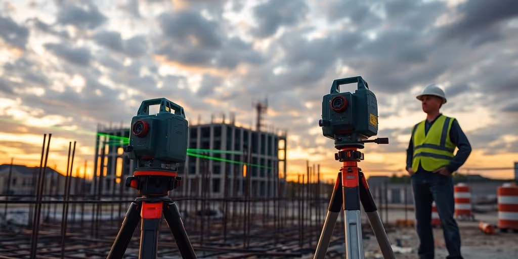
Real Projects: How the RTC 360 Helped Us Cut Survey Time in Half
.avif)
We're diving into how the RTC 360 scanner changed how we do survey work. This tool has really helped us cut down the time it takes to get things done on projects. We'll look at the specific ways it makes our work faster and better, from getting data to finishing up projects.
Key Takeaways
- The RTC360 makes data capture much quicker and more precise.
- Using this scanner helps us finish projects faster and with fewer mistakes.
- It's great for different kinds of projects, like old buildings or new construction.
- The RTC360 works well with other tools for a full picture of the site.
- Getting good data means better plans and models for any project.
Accurate decisions start with accurate data. Our 3D Scanning Services use high-precision LiDAR and reality capture technologies to document real-world conditions at millimeter accuracy—ideal for design, verification, and compliance.
Revolutionizing Survey Workflows with RTC360
Surveying has always been a field demanding precision and efficiency. The introduction of the Leica RTC360 has really shaken things up, offering a new way to approach data capture and project delivery. It's not just about getting the job done; it's about getting it done faster, more accurately, and with a better return on investment. Let's explore how the RTC360 is changing the game.
Streamlining Data Capture for Enhanced Efficiency
Traditional surveying methods can be time-consuming, involving manual measurements and painstaking data entry. The RTC360 changes this by offering rapid 3D laser scanning. This means surveyors can capture entire scenes in minutes, reducing the amount of time spent in the field. This speed translates directly into cost savings and faster project turnaround times. Plus, the automated workflows minimize the need for manual intervention, reducing the risk of human error. It's a win-win.
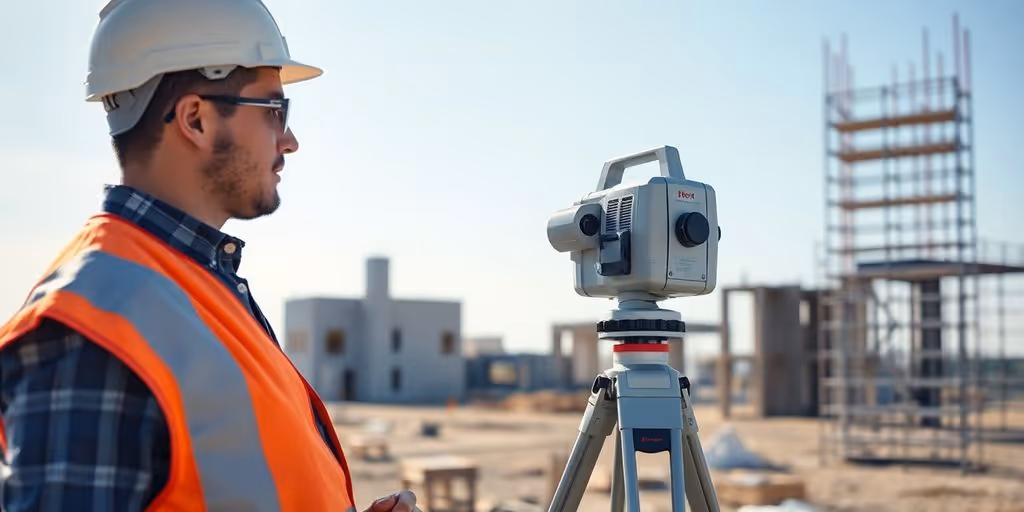
Achieving Unprecedented Accuracy in Field Measurements
Accuracy is the name of the game in surveying, and the RTC360 delivers. Its advanced scanning technology ensures highly precise measurements, capturing even the finest details of a site. This level of accuracy is essential for projects where precision is paramount, such as construction, historic preservation, and infrastructure assessment. The high-quality data produced by the RTC360 allows for more informed decision-making and reduces the potential for costly mistakes down the line. You can even compare the accuracy of 3D point clouds generated by different systems.
If you already have point cloud data but need it transformed into intelligent BIM assets, our Scan to BIM Services are the perfect next step. We generate coordinated, Revit-ready models that support clash detection, design validation and digital twin creation.
Boosting Return on Investment in Survey Projects
Investing in new technology always comes down to ROI, and the RTC360 makes a strong case. By streamlining data capture, minimizing errors, and accelerating project timelines, the scanner helps surveyors achieve a higher return on their investment. The reduced on-site time translates into lower labor costs, and the improved accuracy minimizes the need for rework. Furthermore, the comprehensive data captured by the RTC360 can be used for a variety of purposes, extending the value of the initial investment. It's not just a scanner; it's a strategic asset.
The RTC360 has transformed our surveying process. We're able to complete projects in half the time, with greater accuracy and less manpower. The scanner has paid for itself many times over, and we can't imagine going back to traditional methods.
Whether you're planning space utilization, preparing leasing documents, or creating marketing collateral, our Floor Plans Services deliver clean, scalable floor plan layouts derived directly from high-accuracy field data.
Optimizing Project Delivery Through Advanced Scanning
Accelerating Project Timelines with Rapid Data Acquisition
Okay, so picture this: you're on a tight deadline, and every minute counts. That's where advanced scanning tech, like the RTC360, really shines. It's all about getting the data you need, fast. Instead of spending days or weeks with traditional methods, you can capture everything in a fraction of the time. Think about it – less time on-site means projects move forward quicker, and everyone's happy. It's a game-changer for keeping things on schedule.
Minimizing Errors Through Precise Digital Twins
We all know mistakes can be costly, right? Especially in construction or renovation. But with the RTC360, you're creating a super-accurate digital twin of the site. This means fewer surprises down the road. You can catch potential problems early, before they become major headaches. Plus, having that precise digital model makes planning and execution way smoother. It's like having a crystal ball for your project.
Facilitating Seamless Collaboration Across Teams
Collaboration is key, but it can be tough when everyone's working with different information. The RTC360 helps by creating a single source of truth. Everyone – from architects to engineers to contractors – can access the same data. This makes communication easier, reduces misunderstandings, and keeps everyone on the same page. It's all about streamlining the process and making sure everyone's working together effectively. Plus, with tools like Leica Cyclone FIELD 360 app, you can verify on-site if an area was missed or not scanned.
Advanced scanning isn't just about speed; it's about accuracy, collaboration, and ultimately, delivering better projects. By embracing these technologies, we can transform the way we work and achieve results that were once unimaginable.
Real-World Applications of RTC360 Technology
The RTC360 isn't just a fancy gadget; it's changing how things get done across various industries. From preserving history to planning for the future, the applications are pretty impressive. It's cool to see how this tech is being used in ways I never even considered.
Historic Preservation with Detailed 3D Models
The RTC360 allows for the creation of incredibly detailed 3D models of historical sites. This is a game-changer for preservation efforts. Instead of relying on old photos and documents, historians and architects can now have precise digital replicas. These models help with restoration projects, letting experts see exactly what needs fixing. Plus, these models can be used for educational purposes, giving people a chance to explore historical places virtually. Imagine being able to walk through an ancient castle without leaving your living room! It's also useful for reality capture solutions.
Infrastructure Assessment for Renovation Planning
When it comes to renovating old buildings or infrastructure, the RTC360 is a lifesaver. Traditional methods of assessment can be time-consuming and prone to errors. With the RTC360, you can quickly scan a site and create a detailed point cloud. This point cloud can then be used to measure distances, identify structural issues, and plan renovations with much greater accuracy. This not only saves time but also reduces the risk of costly mistakes during the renovation process. It's like having a super-powered measuring tape that never forgets a detail.
Comprehensive Site Documentation for Future Use
One of the coolest things about the RTC360 is its ability to create comprehensive site documentation. This means that you can scan a site and have a complete digital record of its current state. This is super useful for all sorts of reasons. For example, if you're planning a construction project, you can use the documentation to see how the site changes over time. Or, if you're managing a large facility, you can use it to track maintenance and repairs. Having this kind of detailed documentation can save a lot of headaches down the road.
The ability to quickly and accurately document existing conditions is invaluable. It reduces the need for return visits to the site, minimizes errors in design and planning, and provides a solid foundation for future projects. This is especially important in complex or sensitive environments where access is limited or conditions are constantly changing.
Here's a simple example of how site documentation can be used:
- Baseline Data: Establish a starting point for monitoring changes.
- Progress Tracking: Monitor construction or renovation progress.
- Facility Management: Maintain accurate records for maintenance and repairs.
Integrating RTC360 for Superior Results
Combining Scanners for Complete Site Coverage
To really get the most out of reality capture, you can't just rely on one scanner in isolation. Combining data from multiple scanners, especially the RTC360, is key to achieving complete site coverage. Think of it like this: one scanner gives you a snapshot, but multiple scanners give you the whole picture. This is particularly useful for large or complex sites where a single scan position might miss crucial details. By strategically placing scanners and merging the resulting point clouds, you eliminate blind spots and create a truly comprehensive digital representation of the environment. It's a bit like assembling a puzzle – each scan is a piece, and together they form a complete view. This approach is especially helpful when dealing with obstructions or areas with limited access. You can even hire the Leica RTC360 for specific projects to supplement your existing equipment.
Leveraging VIS Technology for On-Site Verification
VIS (Visual Inertial System) technology is a game-changer when it comes to on-site verification. It's all about making sure your scans are lining up correctly while you're still in the field. No more surprises back at the office! VIS uses the scanner's built-in cameras and inertial measurement unit (IMU) to track its movement and automatically pre-register scans in real-time. This means you can quickly check the alignment of your scans on-site and identify any potential issues before you pack up and leave. It's like having a virtual surveyor looking over your shoulder, ensuring everything is accurate and complete. This saves a ton of time and reduces the risk of costly rework later on.
Seamless Data Flow from Field to Office
One of the biggest benefits of using the RTC360 is the seamless data flow it enables from the field to the office. The scanner is designed to integrate smoothly with processing software, allowing you to quickly and easily transfer your scan data for further processing and analysis. This eliminates the need for manual data entry or cumbersome file conversions, saving you time and reducing the risk of errors. The data flows smoothly, allowing for faster turnaround times and improved collaboration between field and office teams. It's all about streamlining the workflow and making the entire process more efficient.
Integrating the RTC360 into your workflow isn't just about using a new piece of equipment; it's about transforming the way you approach surveying and reality capture. By combining scanners, leveraging VIS technology, and ensuring seamless data flow, you can achieve superior results and unlock the full potential of your projects.
Enhancing Data Processing and Deliverables
Efficient Point Cloud Registration with Cyclone REGISTER 360
Okay, so you've got all this data from the RTC360. Now what? That's where Cyclone REGISTER 360 comes in. It's all about taking those point clouds and getting them aligned, quickly. The software is designed to handle large datasets, so you aren't waiting forever for processing to finish. It's pretty straightforward, even if you aren't a total expert. It's about making the whole process less of a headache.
Generating Accurate 2D Plans and 3D Models
Once your point cloud is registered, you can start making some actual deliverables. We're talking 2D plans, 3D models, the whole shebang. Accuracy is key here, and the RTC360 data, combined with the right software, helps you get there. Think about it: precise measurements translate to better plans and models. This is where the rubber meets the road, where the data turns into something tangible you can use.
Creating Digital Twins for Long-Term Project Value
Digital twins are a big deal these days, and the RTC360 is perfect for creating them. It's about making a virtual copy of a real-world thing, and keeping it updated over time. This is super useful for things like:
- Tracking changes to a building over years.
- Planning renovations without needing to visit the site constantly.
- Having a record of how something was built, for future reference.
Basically, a digital twin is like a time capsule of data. It's not just about what something looks like now, but how it changes and evolves. It's a long-term investment in your project's future.
Strategic Advantages of Reality Capture Solutions
Reducing On-Site Time and Labor Costs
Reality capture solutions are changing how we approach projects. One of the biggest wins is the reduction in time spent on-site. Think about it: fewer trips to the location, less time spent manually measuring, and a smaller team needed overall. This translates directly into lower labor costs and faster project completion. It's not just about saving money; it's about freeing up your team to focus on other important tasks. For example, using reality capture in construction minimizes site visits.
Improving Decision-Making with Comprehensive Data
With traditional methods, you're often working with incomplete information. Reality capture gives you a complete picture. You get detailed point clouds, accurate measurements, and a digital twin of the site. This wealth of data allows for better-informed decisions at every stage of the project. No more guesswork or assumptions – just solid, reliable data to guide your choices. This leads to fewer errors, less rework, and ultimately, a better outcome.
Future-Proofing Projects with Digital Archives
Imagine having a complete digital record of every project, accessible anytime, anywhere. That's the power of reality capture. These digital archives aren't just for documentation; they're a valuable resource for future renovations, expansions, or even historical preservation. It's like having a time capsule of your project, ensuring that the knowledge and data are never lost. Plus, it makes collaboration much easier, as everyone can access the same information.
Reality capture isn't just a trend; it's a fundamental shift in how we approach projects. It's about efficiency, accuracy, and long-term value. By embracing these technologies, we can build a better future, one project at a time.
Unlocking the Full Potential of Leica RTC360
The Leica RTC360 is more than just a scanner; it's a gateway to transforming how you approach reality capture. It's about getting the most out of your investment and pushing the boundaries of what's possible. Let's explore some ways to really make this technology sing.
Expert Tips for Maximizing Scanner Performance
Getting the best results from your RTC360 starts with understanding its capabilities and limitations. Regular calibration is key to maintaining accuracy, especially in demanding environments. Also, pay attention to ambient conditions; extreme temperatures or direct sunlight can impact scan quality. Here are a few more tips:
- Always use the latest firmware to benefit from performance improvements and bug fixes.
- Experiment with different scan settings to find the optimal balance between speed and detail for your specific project.
- Use targets strategically to improve registration accuracy, especially in featureless environments.
Best Practices for Optimal Data Collection
Effective data collection is the foundation of any successful reality capture project. Planning your scan strategy in advance can save significant time and effort in the long run. Consider these best practices:
- Conduct a thorough site survey to identify potential challenges and plan scan positions accordingly.
- Overlap scans sufficiently to ensure robust registration.
- Use the VIS (Visual Inertial System) technology to its full potential for automatic pre-registration.
Strategies for Integrating into Existing Workflows
Integrating the RTC360 into your existing workflows doesn't have to be disruptive. It's about finding the right balance between new technology and established processes. Think about how the RTC360 can streamline your current tasks and identify areas where it can replace less efficient methods.
Start small by piloting the RTC360 on a single project to identify any integration challenges. Train your team thoroughly on the new technology and provide ongoing support. Document your workflows and share best practices to ensure consistency across projects.
Wrapping Things Up
So, what's the big takeaway here? Basically, the RTC 360 scanner really changed how we do things. We used to spend so much time on surveys, and honestly, it was a bit of a headache. But with this new tool, we've cut that time in half. It's pretty wild how much of a difference one piece of equipment can make. If you're in this line of work, and you're still doing things the old way, you might want to look into something like this. It just makes everything smoother and faster, which is what everyone wants, right?
Frequently Asked Questions
What exactly is the RTC360?
The RTC360 is a super-fast 3D scanner that helps people who measure things (like surveyors) do their work much quicker and with fewer mistakes. It takes pictures of places and turns them into 3D models on a computer.
How does the RTC360 help save time and money?
It makes surveying way faster because it captures tons of information in just a few minutes. This means less time spent on-site and more accurate measurements, which saves money and helps projects finish on time.
Can the RTC360 be used for old buildings or historical sites?
Yes, it's great for old buildings! It can make super detailed 3D models of historical sites, helping people plan how to fix them up without causing damage.
What is VIS technology and why is it important?
The VIS technology is like a smart helper inside the scanner. It keeps track of where the scanner is and makes sure you don't miss any spots while you're scanning. It's like having a map that updates itself.
What happens to the data after it's scanned?
After scanning, the data goes into special computer programs like Cyclone REGISTER 360. These programs put all the scanned pieces together to make a complete 3D picture. From this, you can create maps, plans, or even full digital copies of the place.
Can the digital models be used for future projects?
Absolutely! Once you have a digital copy of a building or site, you can use it again and again for future projects, like planning new changes or checking things later on, without needing to go back and measure everything from scratch.
Enhance every stage of your project lifecycle with trusted reality-capture expertise and tailored digital solutions. At Data Capture Service, we combine cutting-edge technology with industry experience to deliver actionable insights and high-quality deliverables that drive better outcomes for AEC professionals, building owners, and facility managers.
- As-Built Documentation Services
- Scan to BIM Services
- 3D Scanning Services
- Floor Plans Creation Services
- Building Surveys Services
- Virtual Tours Creation Services
Ready to explore in more?
Start here:
.avif)
.avif)
.avif)
.avif)
Prefer to Speak Directly?
Experience precision in every project.
