
Key Features of Advanced LiDAR Scanners for AEC Workflows
Key Features of Advanced LiDAR Scanners for AEC Workflows
LiDAR (Light Detection and Ranging) technology has become an indispensable tool in the Architecture, Engineering, and Construction (AEC) sector, prized for its ability to rapidly capture precise, three-dimensional information about sites and structures. However, not all LiDAR scanners are created equal. Modern, advanced systems offer a suite of features specifically designed to meet the rigorous demands of AEC projects. Understanding these key features is essential for AEC professionals when evaluating LiDAR technology or the services of a reality capture provider.
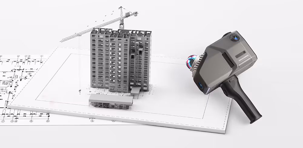
Accurate decisions start with accurate data. With our 3D Scanning Services, we deploy advanced LiDAR scanners (such as Leica RTC360 and BLK series) to capture millions of measurement points from even complex or congested environments — producing reliable point clouds for use in CAD/BIM workflows, verification reports, and digital twins.
Core Performance Metrics
These fundamental specifications dictate the raw capability and suitability of a LiDAR scanner for various AEC tasks:
- Accuracy:
- What it is: Accuracy refers to how close the scanner's measured 3D points are to their true physical positions in space. This is often expressed as a range (e.g., ±3mm at 10m). It encompasses both single point accuracy and the overall network accuracy after multiple scans are registered together.
- Why it matters in AEC: Essential for creating reliable as-built documentation, performing construction verification against design tolerances, precise clash detection, and delivering survey-grade data for critical engineering decisions.
- Considerations: High-end terrestrial LiDAR scanners used in AEC typically offer accuracies in the low millimeter range.
- Range:
- What it is: The maximum distance at which the scanner can reliably detect and measure points on a surface, as well as a minimum effective range.
- Why it matters in AEC: Determines the suitability for scanning large construction sites, tall building facades, long tunnels or corridors, or safely capturing data from inaccessible or hazardous areas.
- Considerations: Scanners are often categorized by range (e.g., short-range up to 70m, medium-range up to 150-300m, long-range 300m+).
- Scan Speed (Point Acquisition Rate):
- What it is: The number of individual measurement points the scanner can capture per second.
- Why it matters in AEC: Higher scan speeds allow for faster data acquisition on site, reducing field time. This enables the rapid capture of dense point clouds over large areas or complex geometries.
- Considerations: Modern scanners typically capture from several hundred thousand to over two million points per second.
- Scan Density / Angular Resolution:
- What it is: The spacing between measured points at a given distance, determined by the scanner's angular resolution (horizontal and vertical step size). Higher density means more points closer together, capturing finer details.
- Why it matters in AEC: Crucial for documenting intricate architectural features, complex MEP (Mechanical, Electrical, Plumbing) systems, or structural details where a high level of detail is required for modeling or analysis. Most professional scanners allow users to select different density settings.
Data Quality and Richness
Beyond basic performance, these features contribute to the overall quality and usability of the captured data:
- Point Cloud Quality (Low Noise):
- What it is: The "cleanliness" of the point cloud, characterized by minimal erroneous or stray points (noise) and sharp, well-defined surfaces.
- Why it matters in AEC: High-quality, low-noise point clouds are easier and faster to process, lead to more reliable feature extraction and modeling (Scan to BIM/CAD), and provide clearer visualizations.
- Integrated High-Dynamic Range (HDR) Imagery / Colorization:
- What it is: Most advanced LiDAR scanners incorporate one or more high-resolution digital cameras that capture panoramic photographs simultaneously with the laser scanning. HDR capabilities allow for balanced image capture in scenes with both very bright and very dark areas. This imagery is used to assign RGB color values to each point in the point cloud.
- Why it matters in AEC: Results in photorealistic, colorized 3D point clouds that are much easier to interpret visually. This aids in the identification of materials and features, facilitates communication with non-technical stakeholders, and provides valuable context. (Systems like the Leica RTC360, which Data Capture Service may utilize, excel at this).
- Dual / Multiple Return Capability:
- What it is: The ability of the LiDAR system to record more than one reflection from a single outbound laser pulse. For instance, a pulse might hit vegetation, with some energy reflecting off leaves (first return), some off branches (intermediate returns), and some penetrating to the ground (last return).
- Why it matters in AEC: Particularly useful in outdoor site surveys for penetrating light vegetation to accurately model the ground surface, or for capturing data through grates or other semi-transparent structures.
- Intensity Values:
- What it is: The scanner records the strength or intensity of the laser pulse that is reflected back from a surface.
- Why it matters in AEC: Intensity values vary based on the material's reflectivity at the laser's wavelength. This data can help differentiate between various materials (e.g., asphalt vs. concrete), identify painted markings, or improve the performance of automated point cloud registration algorithms.
Operational and Workflow Features
These features impact the efficiency, usability, and integration of the LiDAR scanner into AEC workflows:
- Portability and Form Factor:
- What it is: The physical size, weight, and overall design of the scanner, including ease of transport and setup.
- Why it matters in AEC: Lighter, more compact scanners are easier to maneuver in constrained spaces, carry across large sites, and set up quickly, reducing operator fatigue and improving field productivity.
- Ease of Use and On-Site Interface:
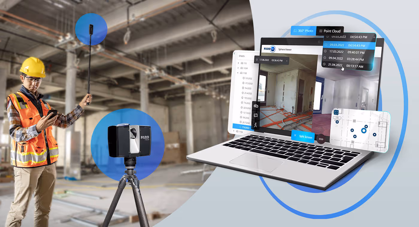
- What it is: User-friendly on-scanner controls, or more commonly, intuitive tablet-based field software (like Leica Cyclone FIELD 360) for managing scan projects, controlling scanner settings, previewing captured data, and performing basic quality checks on-site.
- Why it matters in AEC: Simplifies field operations, reduces the learning curve for operators, minimizes errors, and allows for faster on-site verification of data completeness and quality.
- In-Field Registration / Auto-Registration (e.g., Visual Inertial System - VIS):
- What it is: The capability of the scanner or its accompanying field software to automatically or semi-automatically align (register) successive scans in real-time or near real-time while still on site. Technologies like Leica's VIS (Visual Inertial System) use integrated cameras and IMUs to track the scanner's movement between setups, enabling automatic pre-registration.
- Why it matters in AEC: Provides immediate feedback on scan coverage and alignment quality, significantly reduces office processing time for registration, and helps ensure a complete and coherent dataset is captured before leaving the site.
- Georeferencing Capabilities:
- What it is: The ability to orient the scan data to established project coordinate systems or real-world geographic coordinates. This can be achieved through integrated GNSS (GPS) receivers, surveying known control points (resection/backsighting), or importing project coordinates.
- Why it matters in AEC: Essential for integrating LiDAR data with other project information (e.g., survey data, design BIM models, aerial imagery) and ensuring all data is spatially consistent.
- Environmental Protection (IP Rating):
- What it is: The Ingress Protection (IP) rating indicates the scanner's level of protection against solids (like dust) and liquids (like water).
- Why it matters in AEC: A higher IP rating (e.g., IP54 or greater) signifies better durability and reliability for use in typical construction site conditions, which can be dusty or expose equipment to light rain or moisture.
- Battery Life and Power Options:
- What it is: The duration the scanner can operate on a single battery charge, the availability of hot-swappable batteries, and options for external power input.
- Why it matters in AEC: Ensures uninterrupted scanning for a full workday, minimizing downtime due to power issues.
- Software Interoperability and Data Export Options:
- What it is: The scanner system's ability to export point cloud data in common, open, or widely supported industry formats (e.g., .E57, .LAS, .LAZ, .RCP/RCS, .PTS, .PTG).
- Why it matters in AEC: Crucial for ensuring that the captured data can be easily imported and utilized in various downstream software applications used by different stakeholders, such as CAD programs (e.g., AutoCAD, for which Data Capture Service provides .DWG files), BIM authoring tools (e.g., Revit, for which .RCP files are used), and specialized point cloud processing packages.
Already have point clouds but need intelligent project-ready models? Our Scan to BIM Services translate raw reality capture data into clean, structured Revit models that support design coordination, clash detection, digital twinning, and asset tracking across the building lifecycle.
The Importance of Matching Features to Project Needs
No single LiDAR scanner excels in every feature or is universally "best" for all AEC applications. A project requiring extremely high accuracy for industrial metrology will prioritize different features than a large-scale topographic survey or rapid interior as-built documentation. Understanding the specific requirements of a project—such as required accuracy, level of detail, site conditions, and final deliverables—is key.
Service providers like Data Capture Service assess these project needs to deploy the most appropriate advanced LiDAR scanner and methodology, ensuring that clients benefit from the optimal combination of these key features for their specific objectives.
Advanced LiDAR scanners offer a powerful suite of features that provide significant advantages for a wide range of AEC workflows. By understanding these capabilities—from core performance metrics like accuracy and range to data quality aspects like HDR imagery and operational efficiencies like in-field registration—AEC professionals can better appreciate the value of modern reality capture solutions and make more informed decisions when procuring scanning services or technology.
Ready to turn your space into accurate, usable digital assets? Our team offers a full suite of reality-capture and modeling solutions to support every stage of your project:
- As-Built Documentation Services
- Scan to BIM Services
- 3D Scanning Services
- Floor Plans Creation Services
- Building Surveys Services
- Virtual Tours Creation Services
Ready to explore in more?
Start here:
.avif)
3 Ways 3D Imaging is Improving Modern Construction
Indoor LiDAR Scanning for Facility Management
Applications of LiDAR in Construction Projects
LiDAR vs Traditional Surveying: Pros and Cons
How LiDAR Works: Principles Behind Laser-Based Mapping
Prefer to Speak Directly?
Experience precision in every project.
