
Applications of LiDAR in Construction Projects
Applications of LiDAR Technology Across Construction Project Lifecycles
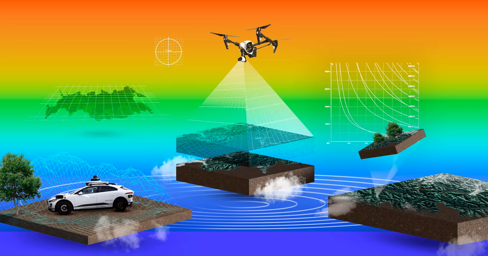
LiDAR (Light Detection and Ranging) technology has become an increasingly indispensable tool in modern construction, offering unparalleled speed, accuracy, and detail in capturing the three-dimensional reality of project sites and structures. Its ability to generate precise point clouds—dense collections of 3D data points—is transforming workflows and decision-making across all phases of a construction project, from initial site assessment and design through active construction to final handover and beyond. This page explores the diverse applications of LiDAR that contribute to more efficient, safer, and higher-quality construction outcomes.
Accurate decisions start with accurate data. Our 3D Scanning Services use high-precision LiDAR and reality capture technologies to document real-world conditions at millimeter accuracy—ideal for design, verification, and compliance.
LiDAR's Role in Construction: An Overview
At its core, LiDAR provides construction professionals with a powerful method to rapidly and accurately measure and document the physical world. This captured 3D data serves as a reliable digital foundation, enabling:
- Informed Decision-Making: Access to precise site and structural information.
- Proactive Risk Mitigation: Early identification of potential issues and discrepancies.
- Enhanced Collaboration: A common data source for all project stakeholders.
- Streamlined Workflows: Integration with digital design and construction processes like BIM (Building Information Modeling).
Applications in the Planning and Design Phase
Before ground is even broken, LiDAR provides crucial insights:
- Topographic Surveys and Site Analysis:
- How it's used: LiDAR, whether ground-based or aerial (drone-mounted), is used to rapidly capture detailed information about a project site's terrain, existing natural features (vegetation, water bodies), man-made structures, and utilities.
- Benefits: Creates highly accurate Digital Terrain Models (DTMs) and Digital Surface Models (DSMs) for precise site assessments, aids in optimal building placement and orientation, supports accurate earthwork calculations (cut and fill volumes), facilitates drainage analysis, and helps identify potential site constraints or opportunities early in the design process.
- Existing Conditions Documentation (As-Built Surveys for Renovations/Retrofits):
- How it's used: When dealing with existing buildings or infrastructure, especially where original plans are missing, outdated, or unreliable, LiDAR is used to scan the structure and create a precise 3D model of its current state. This is a key component of the "Scan to BIM" process.
- Benefits: Provides architects and engineers with an accurate digital baseline for renovation or retrofit designs, significantly reducing the risk of errors, preventing clashes between new designs and existing elements, and minimizing costly surprises once demolition or construction begins.
- Preliminary Design Validation and Visualization:
- How it's used: Conceptual or preliminary designs can be overlaid onto the LiDAR-generated 3D model of the existing site.
- Benefits: Allows for early visualization of the proposed project within its actual context, helping to assess scale, visual impact, line-of-sight issues, and potential design challenges related to the site's topography or surrounding environment.
Applications During the Construction Phase
As the project moves into active construction, LiDAR offers numerous applications for monitoring, verification, and quality control:
- Construction Progress Monitoring and Verification:
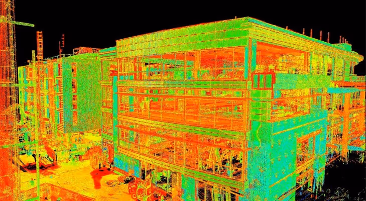
- How it's used: Periodic LiDAR scans of the construction site are captured at regular intervals or key milestones. This as-built scan data is then compared against the design BIM model and the project schedule.
- Benefits: Enables objective tracking of actual construction progress, facilitates early identification of deviations from design specifications (e.g., incorrect placement or dimensions of structural elements, slab flatness issues, out-of-plumb walls), allows for timely corrective actions thereby reducing rework, improves overall quality control, and provides transparent progress reporting.
- Earthwork and Stockpile Volume Calculations:
- How it's used: LiDAR can quickly and accurately scan excavated areas, embankments, or material stockpiles (e.g., soil, gravel, aggregates).
- Benefits: Provides precise volume calculations crucial for verifying quantities for payment to earthmoving contractors, managing material inventory, ensuring design grades are achieved, and optimizing site logistics.
- Structural Steel and MEP Installation Verification:
- How it's used: Scanning recently installed structural steel members, ductwork, piping, cable trays, and major equipment to check for correct alignment, elevation, and placement relative to the design model and other systems.
- Benefits: Helps ensure structural integrity, confirms proper system coordination before subsequent installations conceal these elements, prevents costly rework due to clashes, and aids in QA/QC documentation.
- Facade, Cladding, and Exterior Element Analysis:
- How it's used: Scanning building exteriors during or after the installation of facade panels, curtain walls, windows, or other architectural features to check for alignment, flatness, and adherence to design tolerances.
- Benefits: Provides quality assurance for the building envelope, ensuring aesthetic and performance requirements are met.
- Safety Monitoring and Enhanced Site Logistics Planning:
- How it's used: Creating up-to-date 3D models of the evolving construction site helps in planning safe access routes for personnel and vehicles, optimizing material laydown areas, determining ideal crane placement and swing paths, and identifying potential hazards or restricted zones.
- Benefits: Contributes to enhanced site safety by allowing for better hazard visualization and planning, and improves logistical efficiency by optimizing the use of site space.
Whether you're planning space utilization, preparing leasing documents, or creating marketing collateral, our Floor Plans Services deliver clean, scalable floor plan layouts derived directly from high-accuracy field data.
Applications in the Post-Construction and Handover Phase
Even after construction is substantially complete, LiDAR continues to provide value:
- Final As-Built Documentation:
- How it's used: A comprehensive LiDAR scan of the completed project is performed to create highly accurate and detailed as-built documentation, which can take the form of 2D drawings or, increasingly, intelligent 3D As-Built BIM models. This is a core service offered by Data Capture Service.
- Benefits: Provides the building owner and facility managers with a reliable and precise record of the final constructed asset for project closeout, operational handover, and as the foundational dataset for long-term facility management and the creation of a digital twin.
- Deformation Monitoring and Structural Health Analysis (Long-Term):
- How it's used: For critical infrastructure like bridges, dams, tunnels, or even tall buildings, periodic LiDAR scanning over months or years can detect and quantify minute movements, settlements, or structural deformations.
- Benefits: Offers an early warning system for potential structural issues, aids in planning preventative maintenance, and helps ensure the long-term safety and serviceability of the structure.
Advantages of Using LiDAR in Construction
The integration of LiDAR technology into construction projects brings numerous overarching benefits:
- Increased Accuracy: Significantly reduces human error compared to traditional manual measurement techniques.
- Enhanced Efficiency and Speed: Rapid data capture dramatically reduces time spent on-site for surveying and verification tasks.
- Improved Quality Control: Enables early and frequent detection of errors, deviations, and quality issues.
- Reduced Rework and Costs: Proactive identification and resolution of problems minimizes the need for costly rework and associated delays.
- Better Collaboration and Communication: Provides a clear, accurate, and common 3D understanding of site conditions and project status for all stakeholders.
- Enhanced Safety: Reduces the need for personnel to physically access potentially hazardous or difficult-to-reach areas.
- Comprehensive Data: Captures a vastly greater amount of detailed information compared to traditional surveying methods.
Share your spaces with stakeholders anywhere in the world through immersive 3D digital twins. With our Virtual Tours Creation Services, you can improve communication, enhance marketing efforts and allow remote teams to explore every detail from any device.
Data Capture Service: Leveraging LiDAR for Your Construction Projects
At Data Capture Service, we possess deep expertise in applying advanced LiDAR technology across all phases of the construction project lifecycle. Our services include precise topographic surveys, detailed existing conditions documentation, comprehensive construction verification support, and the creation of accurate as-built documentation in formats such as AutoCAD files and intelligent Revit BIM models. We are committed to providing you with actionable 3D data that seamlessly integrates with your existing workflows, empowering you to make better decisions and achieve superior project outcomes.
LiDAR technology is no longer a niche tool but an increasingly integral component of modern, data-driven construction projects. Its diverse applications, from initial site surveys to final as-built documentation and beyond, contribute significantly to improving the accuracy, efficiency, safety, and overall quality of construction endeavors from start to finish.
Ready to explore in more?
Start here:
.avif)
3 Ways 3D Imaging is Improving Modern Construction
Key Features of Advanced LiDAR Scanners for AEC Workflows
Indoor LiDAR Scanning for Facility Management
LiDAR vs Traditional Surveying: Pros and Cons
How LiDAR Works: Principles Behind Laser-Based Mapping
Prefer to Speak Directly?
Experience precision in every project.
