
The Evolution of 3D Scanning Technology
The Evolution of 3D Scanning Technology: From Concept to Mainstream Application
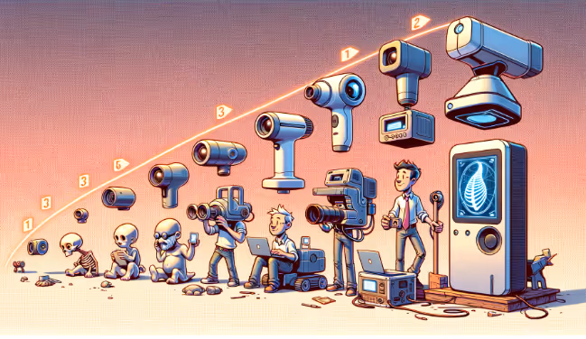
3D scanning, the process of capturing the precise shape and appearance of physical objects or environments and converting them into digital three-dimensional data, has become an indispensable tool across numerous industries. While today's advanced scanners offer remarkable speed, accuracy, and versatility, this technology is not a recent invention. Its current capabilities are the result of decades of research, innovation, and refinement, evolving from early theoretical concepts to the sophisticated instruments used today.
From LiDAR to integrated cloud platforms, today’s 3D scanning tools deliver unprecedented levels of accuracy. Our 3D Scanning Services leverage state-of-the-art hardware like the Leica RTC360 and Matterport Pro3 to give you precise, high-density point clouds tailored to your project.
Early Concepts and Foundational Principles (Pre-1980s)
The ambition to capture and replicate the three-dimensional world digitally has roots that predate modern computing:
- Photogrammetry's Origins: The earliest efforts to derive 3D information from 2D images date back to the 19th century with the development of stereoscopy and photogrammetric surveying techniques. These methods laid the groundwork for understanding how to infer three-dimensional geometry from multiple two-dimensional perspectives.
- Contact-Based Measurement: Before non-contact scanning, Coordinate Measuring Machines (CMMs) emerged in the mid-20th century. These devices use a physical probe to touch points on an object's surface to record XYZ coordinates. While highly accurate for metrology, CMMs are relatively slow, require physical contact (which isn't always desirable), and are limited by the reach of the probe.
- Nascent Optical Theories: Researchers explored various optical principles, including triangulation using light patterns, though practical application was limited by the available technology.
The Dawn of Non-Contact Scanning (1980s - 1990s)
The 1980s marked a pivotal period with the advent of practical non-contact 3D scanning methods:
- Laser Triangulation: This era saw the development of the first laser scanners. These systems typically project a laser line or dot onto an object and use a camera offset at a known angle and distance to observe the laser's reflection. By calculating the angle of the reflected light, the system can determine the 3D coordinates of points on the object's surface through triangulation.
- Structured Light Projection: Simultaneously, structured light scanning techniques were being developed. These involve projecting a known pattern of light (such as stripes, grids, or more complex patterns) onto an object. The way these patterns deform when striking the object's surface is captured by one or more cameras, and algorithms analyze this deformation to reconstruct the 3D shape.
- Early Applications: Initial uses were predominantly in industrial sectors for applications like reverse engineering, quality control, and precise dimensional inspection in manufacturing.
- Challenges: Early 3D scanners were often bulky, expensive, and slow. The computational power required for processing the captured data was significant, and software capabilities were relatively rudimentary.
Advancements and Miniaturization (2000s)
The new millennium brought significant improvements in scanner technology, processing power, and software:
- Time-of-Flight (TOF) LiDAR: This period saw the maturation and wider adoption of TOF LiDAR (Light Detection and Ranging). TOF systems emit a pulse of laser light and measure the time it takes for the light to travel to an object and reflect to the sensor. Knowing the speed of light, the distance can be accurately calculated. This technology enabled much longer scanning ranges, making it suitable for large-scale surveying, architectural documentation, and terrain mapping.
- Phase-Shift LiDAR: Another advancement in LiDAR technology, phase-shift systems, compare the phase of the emitted laser light with the reflected light. This method offers high accuracy, particularly at medium ranges, and often faster data acquisition rates than early TOF systems.
- Improved Processing Power and Algorithms: Rapid increases in computer processing speeds and the development of more sophisticated algorithms for point cloud registration (aligning multiple scans), filtering, and meshing were critical for making 3D scanning more practical.
- Software Development: More user-friendly software packages emerged, capable of handling the increasingly large point cloud datasets generated by scanners.
- Increased Portability: Scanners began to shrink in size and weight, becoming more field-deployable.
- Expanding Applications: The use of 3D scanning expanded beyond industrial metrology into fields such as architecture (as-built documentation), heritage preservation (digitizing historical artifacts and sites), and forensics.
The Era of Accessibility and Integration (2010s - Present)
The last decade and a half have been characterized by a democratization of 3D scanning technology and its deeper integration into various workflows:
- Democratization and Affordability: The cost of 3D scanning hardware began to decrease, with more affordable entry-level structured light scanners and advancements in photogrammetry (using standard digital cameras, including those on smartphones) making 3D capture accessible to a broader audience.
- Integrated Platforms: Companies like Matterport emerged, offering all-in-one solutions that combined proprietary camera hardware with cloud-based processing and user-friendly interfaces, making the creation of immersive 3D virtual tours straightforward, especially for real estate and visual documentation.
- SLAM (Simultaneous Localization and Mapping): The development and refinement of SLAM algorithms revolutionized mobile mapping. SLAM enables scanners (often handheld or mounted on mobile platforms) to determine their position and map an environment simultaneously without relying on external tracking systems like GPS, which is often unavailable indoors.
- Sensor Fusion: Modern scanners increasingly incorporate multiple sensor types – such as LiDAR, cameras (for colorization and photogrammetry), Inertial Measurement Units (IMUs for motion tracking), and GPS – to produce richer, more accurate, and geo-referenced data.
- Cloud Computing: Cloud platforms have become essential for processing, storing, managing, and collaboratively sharing the massive datasets generated by 3D scanners.
- Artificial Intelligence (AI) and Machine Learning (ML): AI and ML are increasingly being applied to point cloud data for tasks like automatic object classification (identifying walls, floors, pipes, etc.), feature recognition, and to assist in the automated conversion of point clouds to intelligent BIM models (Scan to BIM).
- Continued Miniaturization: LiDAR sensors and other 3D scanning components have become small enough to be integrated into a wider range of devices, including some high-end tablets and smartphones.
- Seamless Workflow Integration: Significant progress has been made in streamlining the integration of 3D scan data into CAD and BIM software, facilitating workflows like Scan to BIM and Scan to CAD for as-built modeling, design verification, and construction monitoring.
Need intelligent BIM outputs from point clouds? Our Scan to BIM Services use AI-aware modeling workflows to generate accurate Revit models from reality capture data—perfect for design coordination, clash detection, and digital twins.
Today's Landscape and Data Capture Service
The current 3D scanning landscape is diverse, offering a wide range of technologies suited to countless applications, characterized by high accuracy, speed, portability, and increasing intelligence. At Data Capture Service, we leverage this evolved technology to provide our clients with superior outcomes. We utilize:
- Advanced LiDAR systems (like those from Leica Geosystems): For projects demanding the highest levels of precision, range, and detail for as-built surveys, Scan to BIM, and critical measurements.
- Sophisticated integrated platforms (like the Matterport Pro 3): For creating immersive 3D virtual tours, efficient spatial documentation, and visually rich models for real estate, insurance, and facilities.
Our approach is to understand the specific needs of each project and deploy the most appropriate, state-of-the-art 3D scanning technology to deliver accurate, actionable data.
The journey of 3D scanning technology from niche, expensive equipment to the versatile and increasingly accessible tools of today has been remarkable. Its ongoing evolution continues to unlock new possibilities and drive innovation across a multitude of industries, and Data Capture Service remains committed to applying these advancements for the benefit of our clients.
Transform the way you document, model, and showcase your built environments with our comprehensive range of professional services:
- As-Built Documentation Services
- Scan to BIM Services
- 3D Scanning Services
- Floor Plans Creation Services
- Building Surveys Services
- Virtual Tours Creation Services
Ready to explore in more?
Start here:
Comparing 3D Scanners: Photogrammetry vs Laser
Benefits of 3D Scanning for Historical Preservation
3D Scanning for Manufacturing & Product Design
The Role of 3D Scanning in As-Built Documentation
Matterport 3D Scanning for Real Estate and Beyond

Building Information Modeling (BIM) with 3D Scanning
The Role of 3D Scanning in As-Built Documentation
Building Information Modeling (BIM) with 3D Scanning
Matterport 3D Scanning for Real Estate and Beyond
Prefer to Speak Directly?
Experience precision in every project.
